JOURNEY TO THE PAST
Pre-Spanish and Spanish Era
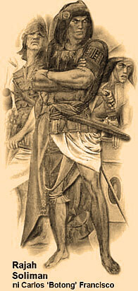
The inhabitants of Rizal province of yore enjoyed the best of two shores -- the seashore of Manila Bay on its western fringes with its famous sunset, and the lakeshore of Laguna de Bai at its eastern border, noted for its picturesque view of the Philippines' largest inland body of water. Laguna de Bai named after the Laguna town of Bai, which used to be the biggest settlement along the western edge of Asia's second largest freshwater basin, looks like the cavity of the human heart. The dagger-shaped Talim island lying in the middle divides the lake into two sections, along with three islets hugging the island's coast. During the pre-Spanish times, the settlements located along the lakeshore of Laguna de Bai (Bay) and on the southern banks of the Pasig River were ruled by Rajah Soliman, nephew of Rajah Lakandula, the chief of Tondo.

When Miguel Lopez de Legazpi defeated the forces of the rajahs due to the superiority of their mechanical weapons, and in spite of the fierce and desperate heroism and resistance of the local warriors who were defending their own turf, the first Spanish Governor General sent his nephew, the young Captain Juan de Salcedo, to conquer and pacify the towns in the southern districts of Luzon.
In 1571, Salcedo conquered the towns one after another, winning through diplomacy, the friendship and confidence of the natives.
The towns were organized into municipal units of the central Spanish government in Manila. After which, Spanish missionaries , mostly Franciscan and Jesuit, were sent to build churches or chapels in the newly-organized towns, to propagate the tenets of the Catholic religion, to Christianize and baptize people, and to spread among them the Spanish culture.
The first catholic church in this region was constructed by the Jesuit missionary Father Pedro Chirino, a famous Spanish scholar who wrote many books on Philippine history in Tagalog language.
Salcedo, after conquering the towns of Taytay and Cainta, proceeded to the town of Paracale in Bicol, traversing what is now the province of Laguna.

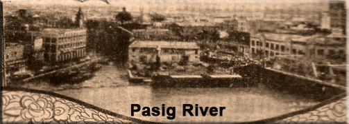
A riverine settlement since the pre-Hispanic era, Rizal has a 25km-long Pasig River that originates from the lake and empties into Manila Bay. On its northeastern banks is Malacañang Palace where the seat of power emanates. It is the center of political power and influence and the home of the archipelago's former Spanish and American Governor-Generals, and of the Commonwealth's and the Republic's succession of Chief Executives.
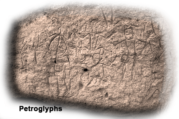
Rizal Province is undoubtedly the country's repository of its artistic legacy as evidenced by an "art exhibit" ongoing for the past 3000 years composed of more than 120 man-like, frog-like and lizard-like stone carvings called Petroglyphs. These were engraved by its prehistoric artists on the wall of a secluded rock shelter near a cave in the uplands of Angono around 1000 BC.

Before Rizal became a province, its area used to be the provinces of Tondo and La Laguna during the Spanish era. However, some of its towns like Pasig, now the Provincial Capital, Parañaque, Taytay and Cainta, were alreeady thriving Tagalog communities engaged on trade with the Chinese and our other Asian neighbors long before the Spaniards set foot on the islands in 1521.
A succession of religious orders like the Franciscans, the Augustinians, the Jesuits, and the Recollects had taken jurisdiction over this wide swath of bustling communities prior to the birth of Rizal Province.
In 1853, the towns of Morong, Pililla, Tanay, Baras, Binangonan, Jalajala, Angono, Antipolo, Boso-Boso, Cainta, and Taytay, were weaned from the province of Tondo and were named Distrito Politoco-Militar de los Montes de San Mateo.
|